Are you looking for a way to easily view and share your outdoor adventures? Have you ever heard of GPX files? GPX stands for GPS eXchange Format, and it’s a popular file format used for storing geographic data. GPX files can contain GPS coordinates, waypoints, routes, and tracks that are recorded from outdoor activities like hiking, cycling, and sailing.
If you’ve collected GPS data in a GPX file, you may be wondering how to open it on your iPhone. Fortunately, there are several apps available that can open and display the information contained in a GPX file. One of the most popular apps is called ViewRanger, which is available both as an iOS app and a web platform. It offers features like route planning/sharing as well as offline maps and augmented reality (AR) navigation tools.
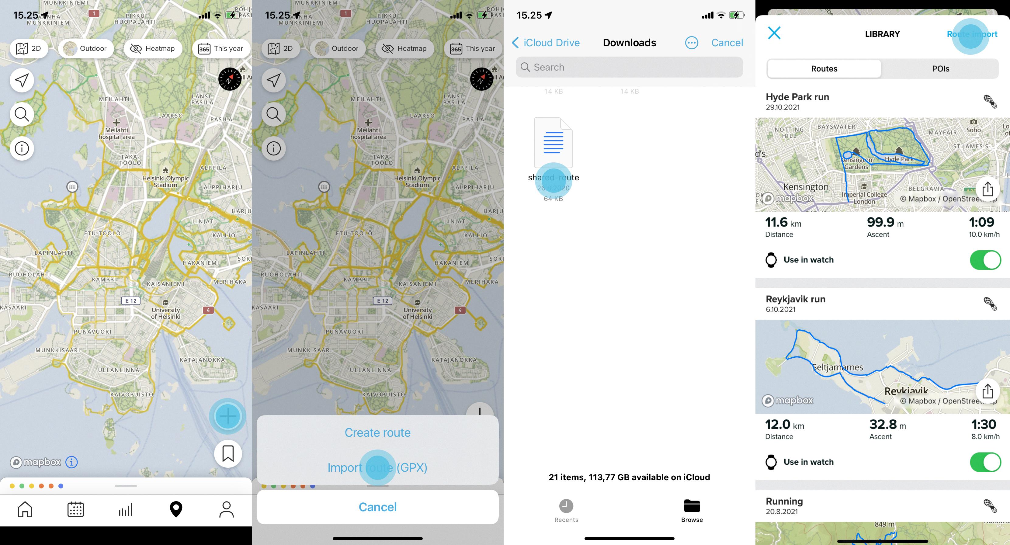
In order to open a GPX file with ViewRanger on your iPhone:
1. Download the ViewRanger app from the App Store
2. Open the app and sign in or create an account
3. Tap the “Add New Route” button at the bottom right of the screen
4. Select “Import File” from the list of options
5. Tap “GPX File” from the list of formats
6. Select your desired file from your device’s storage or choose a file stored in an online service like Dropbox or Google Drive
7. Once selected, tap “Import” to add it to your route library
8. You can now view your route on an interactive map within ViewRanger!
With ViewRanger, you can also share your routes with other users by tapping “Share Route” when viewing any saved route in your library. This allows friends or family members to access detailed information about where you went and how long it took while they follow along virtually! Additionally, ViewRanger offers several different map types including topographical maps so that you can get an even more detailed look at elevation changes along your route if desired.
Overall, using ViewRanger is a great way to view GPX files on iPhone devices! With its various features like sharing capabilities and offline maps support, it provides everything needed for anyone looking to explore their outdoor adventures through detailed GPS data stored in GPX files!
Opening GPX Files
Opening GPX files is easy. First, you need to find the file on your computer and open it with a text editor or a specialized GPS data viewer program. Some of the most popular programs for viewing GPX files are GPS Visualizer, Maps Marker, and GPS Track Editor. Once you’ve opened the GPX file in one of these programs, you’ll be able to view the map data contained within it. You can also upload your GPX file to the web version of Google Maps for easy viewing. To do this, open Google Maps in your web browser and select Your places? Maps? Create a map from the menu. Then simply drag and drop your GPX file into the map window to add it as a new layer.

Source: suunto.com
Can GPX Files Be Opened in Google Maps?
Yes, you can open GPX files in Google Maps. GPX is a widely-used file format for storing and sharing GPS data. Many GPS-enabled devices and apps store tracking information in GPX files, which can be easily uploaded to Google Maps for viewing. To open a GPX file in Google Maps, simply select “Create Map” from the “Your Places” menu and upload the file. Once uploaded, the route will be displayed on the map with options for viewing details such as elevation or speed. Additionally, you can also view the tracks on your mobile device by downloading the Google Earth or Maps app.
Downloading a GPX File
In order to download a GPX file, you’ll need a few things:
1. A computer with an internet connection.
2. A Garmin device that is compatible with the GPX file format (most Garmin devices are).
3. The appropriate cable for connecting your Garmin device to your computer.
4. An activity page from which to download the GPX file from (these can be found on various websites or apps).
Once you have these items, simply plug your Garmin device into your computer and navigate to the activity page where you would like to download the GPX file from. On this page, you’ll find a GPX Download button located at the top-right corner of the activity’s map – click this button to download the GPX file directly onto your device.
What is the Meaning of GPX?
GPX stands for GPS Exchange Format. It is a format used to store geographic data such as waypoints, tracks, and routes in a text file that can be exchanged between GPS units and computers. This allows users to easily transfer data between different devices while also providing a standard format for storing this information. GPX files are commonly used by hikers, cyclists, and other outdoor enthusiasts who need to keep track of their location and movements during an outing.
Conclusion
In conclusion, GPX files are a great way to store and share data that contains geographical information. They’re easy to use, open, and view using the web version of Google Maps. With GPX files you can save routes, track your movements, and easily share your location data with others. Overall, GPX files provide an effective way to store and share location information.


